PREFACE, xxxv xxxvi xxxvii xxxviii xxxix |
|
||||||||||||||||||||||||
 |
|||||||||||||||||||||||||
| HISTORICAL
INTRODUCTION: |
|||||||||||||||||||||||||
A.-The Science of Oceanography, |
1 |
||||||||||||||||||||||||
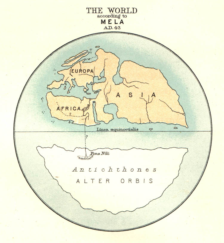
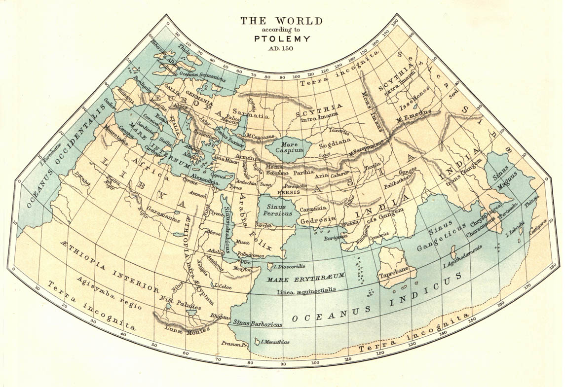
B.-Oceanographical Views of the Ancients, 002 003 004 005 006 007 008 009 010 011 012 013 014 015 016 017 018 019 020 021 022 023 024 025 026 027 028 |
2 |
||||||||||||||||||||||||
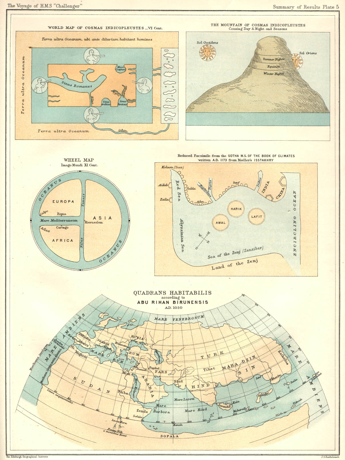
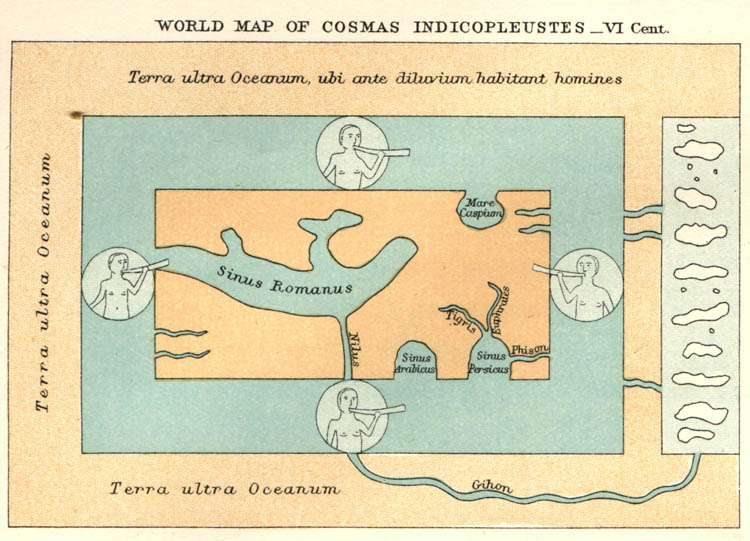
C.-Oceanographical Views during the Dark Ages, the Middle Ages, and the Renaissance, 029 030 031 032 033 034 035 036 037 038 039 040 041 042 043 044 045 |
29 |
||||||||||||||||||||||||
D.-Progress of Oceanographical Knowledge, from the Voyage of Magellan to the Voyages of Cook, 046 047 048 049 050 051 052 053 054 055 056 057 058 059 060 061 062 063 064 065 066 067 |
46 |
||||||||||||||||||||||||
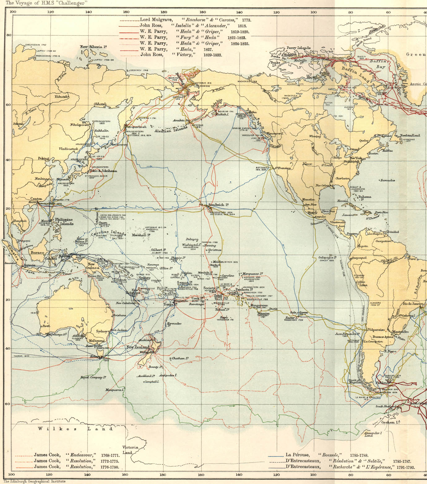
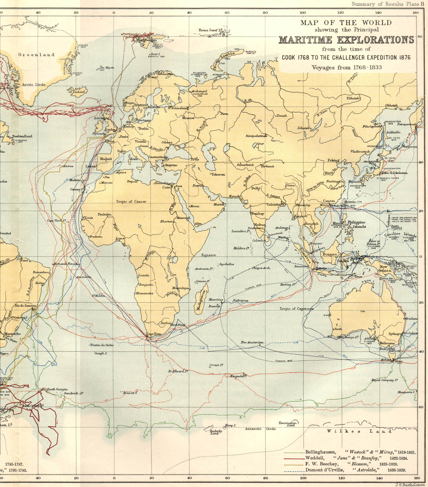
E.-The Progress of Oceanography from the Time of Cook to the Challenger Expedition, 068 069 070 071 072 073 074 075 076 077 078 079 080 081 082 083 084 085 086 087 088 089 090 091 092 093 094 095 096 097 098 099 100 101 102 |
68 |
||||||||||||||||||||||||
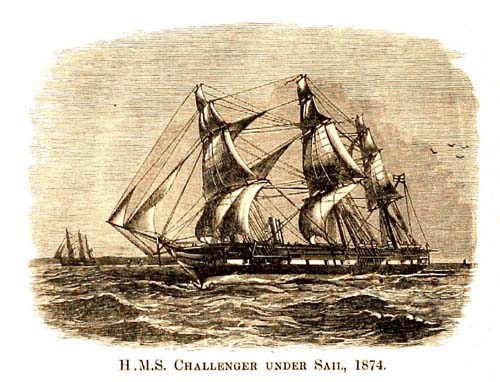
F.-The Explorations of the Challenger, and subsequent Expeditions, 103 104 105 106a 106b 106c 106d 106e |
103 |
||||||||||||||||||||||||
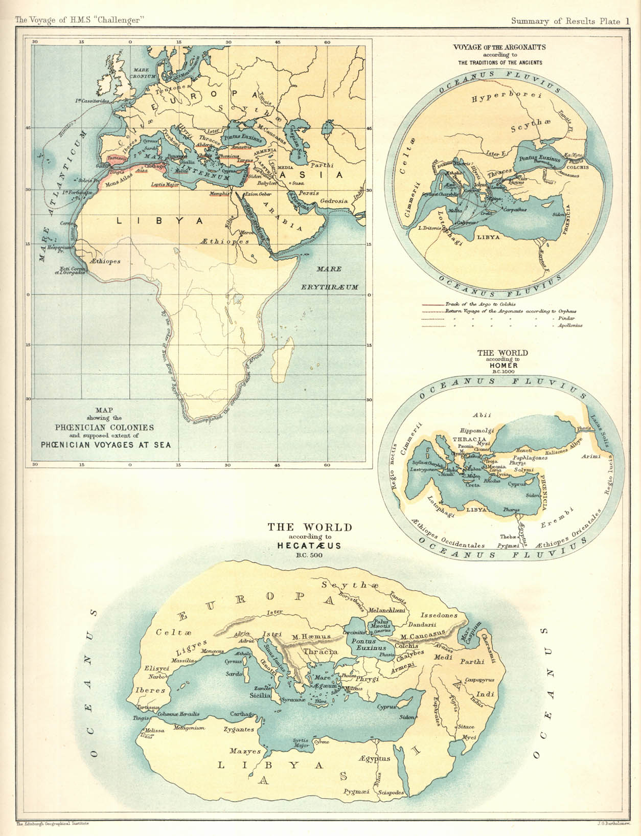
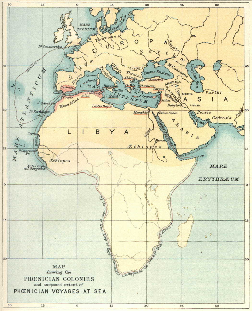
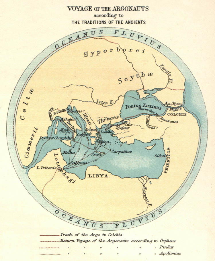
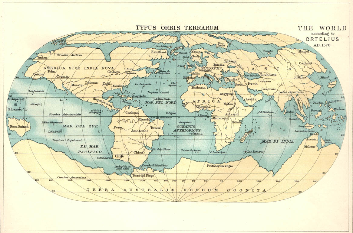
I. MAPS ILLUSTRATING THE HISTORY OF OCEANOGRAPHY. Note the Plates linked to this table are at 150 ppi resolution. The plates are also available at 800 ppi resolution.
|
|||||||||||||||||||||||||
| GENERAL
SUMMARY of the Scientific Observations and Results at each of the
Challenger
Observing Stations |
Contents
of Pages 107 to 1274 |
||||||||||||||||||||||||
| BATHYMETRICAL
AND GEOGRAPHICAL DISTRIBUTION, |
1275 |
1. Animals obtained in the Dredgings and Trawlings in the Zone deeper than 2500 fathoms, |
1277 |
2. Animals obtained in the Dredgings and Trawlings in Depths between 2000 and 2500 fathoms, |
1283 |
3. Animals obtained in the Dredgings and Trawlings in Depths between 1500 and 2000 fathoms, |
1291 |
4. Animals obtained in the Dredgings and Trawlings in Depths between 1000 and 1500 fathoms, |
1302 |
5. Animals obtained in the Dredgings and Trawlings in Depths between 500 and 1000 fathoms, |
1314 |
6. Animals obtained in the Dredgings and Trawlings in Depths between 100 and 500 fathoms, |
1328 |
7. Animals obtained in the Dredgings and Trawlings in Depths under 100 fathoms, |
1362 |
| GENERAL
OBSERVATION ON THE DISTRIBuTION OF MARINE ORGANISMS, |
1431 |
| EXPLANATION
OF CHARTS AND DIAGRAMS (APPENDIX I.), |
1463 |
| INDEX
OF GENERA, SUB-GENERA, SPECIES, AND VARIETIES, |
1465 |
| GENERAL
INDEX, |
1575 |
| CONTENTS, PARTS 1 & 2 |
1610 |
| Chart |
Description |
| IA. |
Hemisphere
showing depths in the Atlantic Ocean, In pocket of cover to First Part
|
| IB. |
Hemisphere
showing depths in the Pacific Ocean, In pocket of cover to First Part
|
| IC. |
Hemisphere
showing depths in the Indian Ocean,
In pocket of cover to First Part
|
| 2. |
England
to the Canary islands, touching at Lisbon, Gibraltar, and Madeira; also
towards England
from the Cape Verde Islands, touching at Vigo, |
| 3. |
In
the vicinity of Lisbon, |
| 4. |
In
the vicinity of Madeira Island, |
| 5. |
In
the vicinity of the Canary Islands, |
| 6. |
Canary
Islands to St. Thomas, St. Thomas to Bermuda, Bermuda to the Azores,
Azores to
Madeira,
and Madeira to Cape Verde Islands ; also towards England from the Cape
Verde Islands, |
| 7. |
In
the vicinity of the Virgin Islands, |
| 8. |
In
the vicinity of Bermuda, |
| 9. |
Bermuda
to Halifax, crossing the Gulf Stream in the meridian of 70° W., and
Halifax to
Bermuda,
crossing the Gulf Stream in the meridian of 63° W., |
| 10. |
In
the vicinity of the Azores, |
| 11. |
In
the vicinity of the Cape Verde Islands, |
| 12. |
Cape
Verde Islands to Bahia, touching at St. Paul's Rocks and Fernando
Noronha; also Ascension to Cape Verde Islands, |
| 13. |
In
the vicinity of St. Paul's Rocks, |
| 14. |
In
the vicinity of Fernando Noronha, |
| 15. |
In
the vicinity of the Coast of Brazil, |
| 16. |
Bahia
to the Cape of Good Hope, touching at the Tristan da Cunha Islands;
also Monte Video to
Ascension, |
| 17. |
In
the vicinity of the Tristan da Cunha Islands, |
| 18. |
Cape
of Good Hope to the parallel of 60° S., touching at the islands of
Marion, Crozet, Kerguelen,
and Heard, |
| 19. |
In
the vicinity of Prince Edward and Marion Islands, |
| 20. |
In
the vicinity of the Crozet Islands, |
| 21. |
In
the vicinity of Kerguelen Island, |
| 22. |
In
the vicinity of Heard Island, |
| 23. |
In
the neighbourhood of the Antarctic Circle, between the 78th and 98th
meridians of east
longitude,
showing the position of Pack Ice and floating Icebergs encountered, |
| 24. |
From
a position in lat. 59° 56' S., long. 99° 14' E. to Melbourne, |
| 25. |
Melbourne
to Sydney, |
| 26. |
In
the vicinity of Sydney, N.S.W., |
| 27. |
Sydney
to Wellington, touching at Port Hardy and Queen Charlotte Sound;
Wellington to Fiji
Islands, touching at Tongatabu ; and Fiji Islands, to Cape York,
touching at Api Island and Raine Islet, |
| 28. |
In
the vicinity of Tongatabu, |
| 29. |
In
the vicinity of Matuku Island, |
| 30. |
In
the vicinity of Ngaloa Harbour, Fiji islands, |
| 31. |
Cape
York to Hong Kong, touching at the Arrou Islands, Ki Islands, Banda
Islands, Amboina
Island, Ternate Island, Samboangan, Ilo Ilo, and Manila; also Hong Kong
to Yokohama,
touching at Manila, Zebu, Samboangan, Humboldt Bay, and the Admiralty
Islands, |
| 32. |
In
the vicinity of the Arrou and Ki Islands, |
| 33. |
In
the vicinity of the Banda
Islands, |
| Chart |
Description |
| 34. |
Nares
Harbour, Admiralty islands, |
| 35. |
In
the vicinity of Japan, |
| 36. |
Yokohama
to the Sandwich Islands, |
| 37. |
In
the vicinity of the Sandwich Islands, |
| 38. |
Sandwich
Islands to Tahiti also Tahiti to Valparaiso, touching at Juan Fernandez
Island, |
| 39. |
In
the vicinity of Tahiti, |
| 40. |
Valparaiso
to Port Otway, |
| 41. |
Port
Otway through Magellan Strait, touching at Hale Cove, Gray Harbour,
Port Grappler,
Tom
Bay, Puerto Bueno, Isthmus Bay, Port Churruca, Port Famine, Sandy
Point, and Elizabeth Island, |
| 42. |
Magellan
Strait to the Falkland Islands and Monte Video, |
| 43. |
In
the vicinity of Ascension, |
| Diagram |
Description |
| 1. |
Longitudinal
section, Tenerife to Sombrero, |
| 2. |
Diagonal
section, Bermuda
towards New York ; also Meridional section, Halifax to St. Thomas, |
| 3. |
Longitudinal
section, Bermuda to the Azores and Madeira, |
| 4. |
Longitudinal
section, from a position
in tat. 3° 8' N., long. 14° 39' W. to Pernambuco, |
| 5. |
Diagonal
section, Abrolhos Island to
Tristan da Cunha Islands, |
| 6. |
Longitudinal
section, Rio de la Plata to Tristan da Cunha
Islands and the Cape of Good Hope. |
| 7. |
Meridional
section, the Azores to the Tristan da Cunha Islands, |
| 8. |
Meridional
section, Cape of Good Hope to the parallel of 46° S., |
| 9. |
Meridional
section between the
parallels of 50° and 65° S. lat., |
| 10. |
Diagonal
section, from a position in lat. 53° 55'
S., long. 108° 35' E. to, Cape Otway, |
| 11. |
Longitudinal
section, Sydney, N.S.W., to
Porirua, Cook Strait, New Zealand, |
| 12. |
Meridional
section, Kandavu Island to Cape Palliser,
New Zealand, |
| 13. |
Longitudinal
section, Fiji Islands to the Barrier Reef, Australia, |
| 14. |
Diagram
showing the Distribution of Temperature in the Seas enclosed by the
Islands of the Eastern
Archipelago, |
| Diagram |
Description |
| 15. |
Longitudinal
section, Meangis Islands to the Admiralty Islands, |
| 16. |
Meridional
section, Admiralty Islands to Japan, |
| 17. |
Longitudinal
section, Japan to a position in lat. 35° 49' N., long. 180° W., |
| 18. |
Longitudinal
section, from a position in lat. 35° 49' N., long. 180° W. to a
position in lat. 38° 9'
N.,
long. 156° 25' W., |
| 19. |
Meridional
section, from the parallel of 38° N. to the
parallel of 40° S., |
| 20. |
Longitudinal
section, from a position in lat. 40° 3' S., long. 132° 58' W. towards
Mocha
Island, |
| 21. |
Meridional
section, off the west Coast of South America, between the 33rd and 46th
parallels, |
| 22. |
Meridional
section, Falkland Islamls to the parallel of 35° 40' S., |